A more detailed tutorial for maps and travel routes is coming this week…
1 Like
That’s good to know.
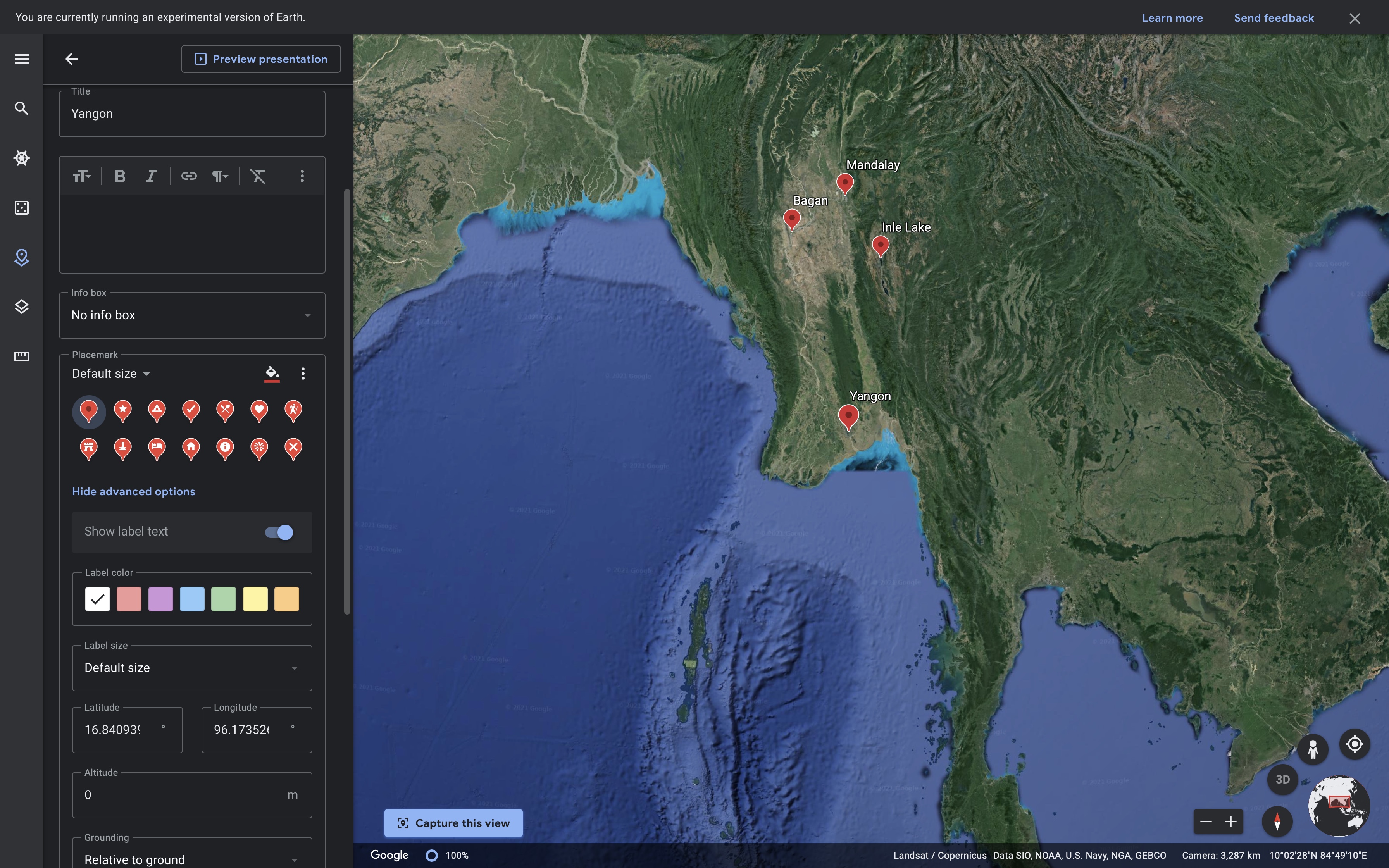
Since I don’t have the GPS files for my travels and don’t like putting straight lines between my destinations unless I am flying, would it possible to just add selected place names to the maps? This is what I currently do with Google Maps and it would be nice to have it integrated within Fotomagico. Here’s an example of the kind of thing I mean:
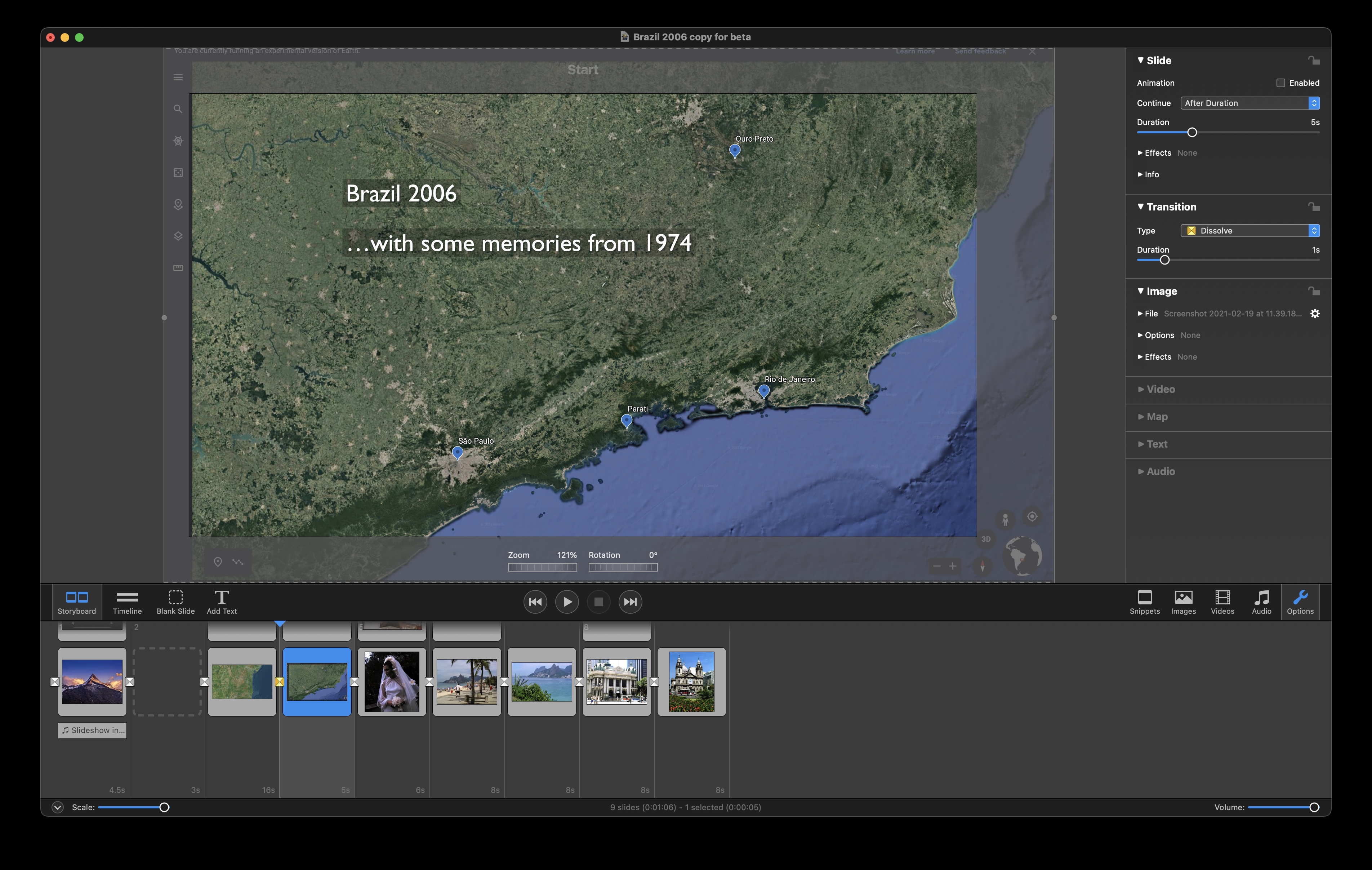
With the maps so far in this beta I can’t see how to reveal place names in satellite view!
You say you can’t reveal place names in satellite view. That’s correct – there are no place names in that view. Choosing “Hybrid” will show them, although there are way too many if you want something like what you’re showing in the top image. You can still use Satellite view and then add the place names yourself as text (although at the moment it’s cumbersome since the “Add Title” feature has some glitches.
I guess the would work, providing one can add a “dot” as a place-marker. And once the text function is working properly.
By the way, in both Hybrid and Satellite view there is a tick box to show “points of interest”. Ticking it makes no difference.
The Points of Interest works in all but the satellite view. It’s possible you just haven’t found anything that shows and disappears when you click on it in the map area you have displayed. I live in California, and some of the Points of Interest like State Parks, Pacific Ocean, etc. do show up. I DON’T KNOW where the Points of Interest are coming from (there’s gotta be a file hiding in the support files somewhere. So it would all be subjective as to what a point of interest means to each person.
As for adding a “dot” – I’ve done a number of slide shows in previous versions of FM and I find the easiest way is to use the “bullet” symbol from almost any common font (usually created by holding down Option-8 at the same time (like this •). You can either include it WITH the label, and size it and adjust it’s baseline accordingly, but the quicker way is to just create a text label and just make the bullet on its own – size it and color it as appropriate, and then just move it around to where you want it. I threw this example together quickly.
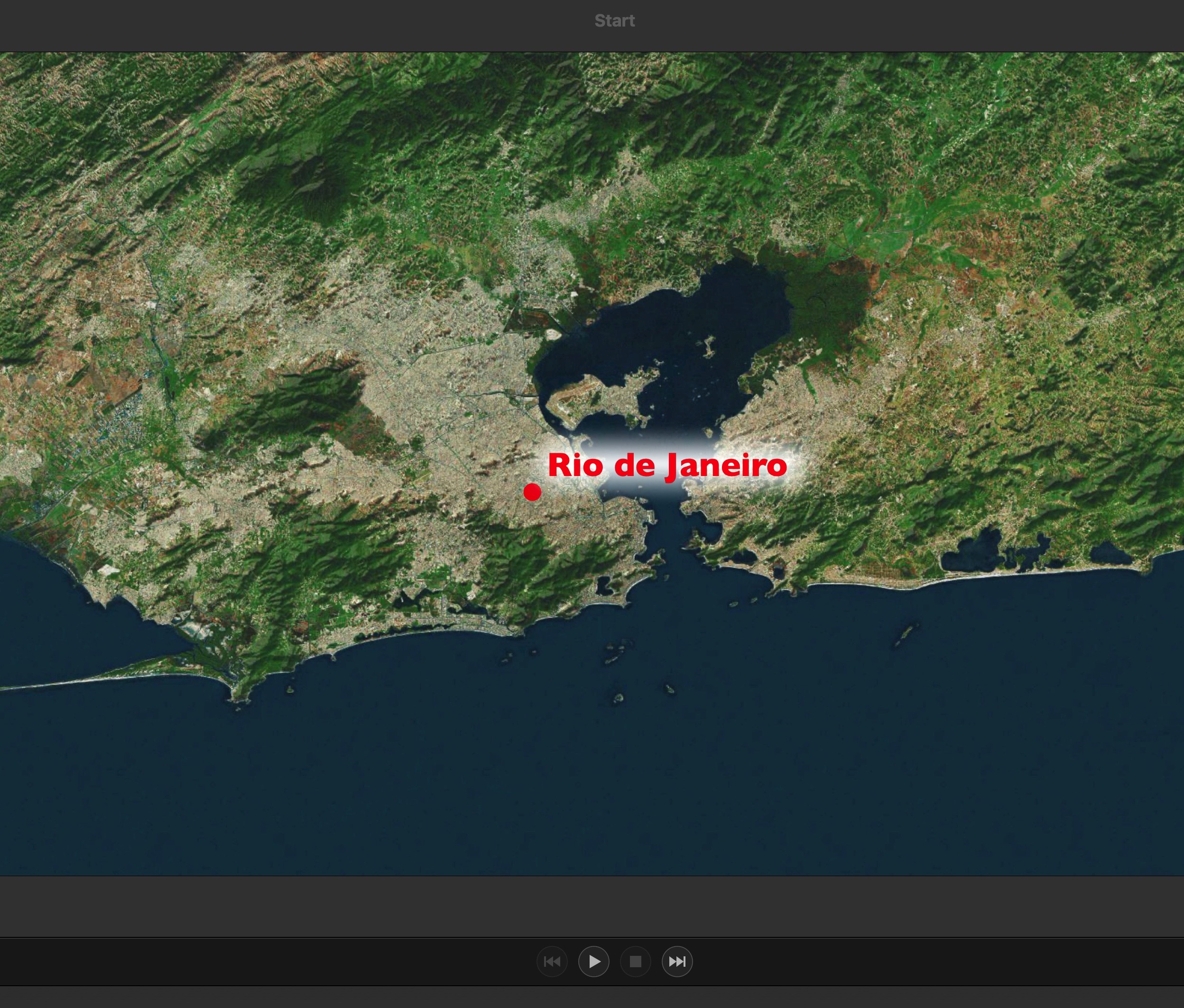
I did try something like your solution for my slideshow maps, but using Google Earth is a lot quicker and involves just a few clicks. The only downside is that it does not allow (as far as I can see) any changes to the font, although I could import my own custom icon if I wanted:
Congratulations, I always missed this function when visualising my trips. Eventually you could optionally show a map scale for small scale map areas.
Update:
-
While testing Maps Assistant more or less the whole weekend (stormy Wether with snowfall) I found a lot to strange effects that can beet be shown by screenshot, but I have no Idea how to upload.
-
I cannot count so far I killed Fotomagico process because never ending rolling beach ball. Most were caused especially by saving (explicit and implicit after closing (<cmd W)
-
I experienced with track routes of my journeys (unfortunately must all KML files converted to GPX), why no option to use both formats? One (Sicily) worked perfect, Marocco never came to a result except beach ball.
-
Cannot used for big distances (tried to make a map from a cruise from L.A. to Sidney via different islands)
That’s what I did. I converted using on of those free online converters. Maybe there are others that might work. Otherwise, the tutorial I cited above explains how to create a map in Google Earth Studio and then exporting it as a movie. This might be a way to bypass the FM6 map assistant altogether and I will certainly play around with it!
why are you looking for ways to create kml files from google maps that are not supported by FM6?
I do a lot of geocaching, a lot LESS hiking than I used to (unfortunately), and road trips or international trips (again, less than I would like) and I almost always create a .gpx file of my excursions. I download those .gpx files from my handheld Garmin GPS unit and I can do all kinds of things with it (like throwing it into Google Earth), or messing around with the track somehow to throw it into Adobe Illustrator or Adobe Photoshop. I’ve tested the .gpx function in the new Map Assistant and it has worked just fine. As willyman posted, I’m not sure WHY you would want to create a .kml file from Google Maps that are NOT supported in FM6.
I shouldn’t have pressed Reply so soon  I just did a Google search and there are numerous websites that will do a FREE on-line conversion from a .kml file to a .gpx file – so I think it’s a moot point.
Not sure why an earlier post of mine didn’t get saved. The one in which I mentioned the tutorial!

Hi Oliver, cool function - with FM 5 I‘ve used to go with a subfunction of iMovie to create an animated route. I am curious to learn in more detail if this will work with the Maps Assistant too.
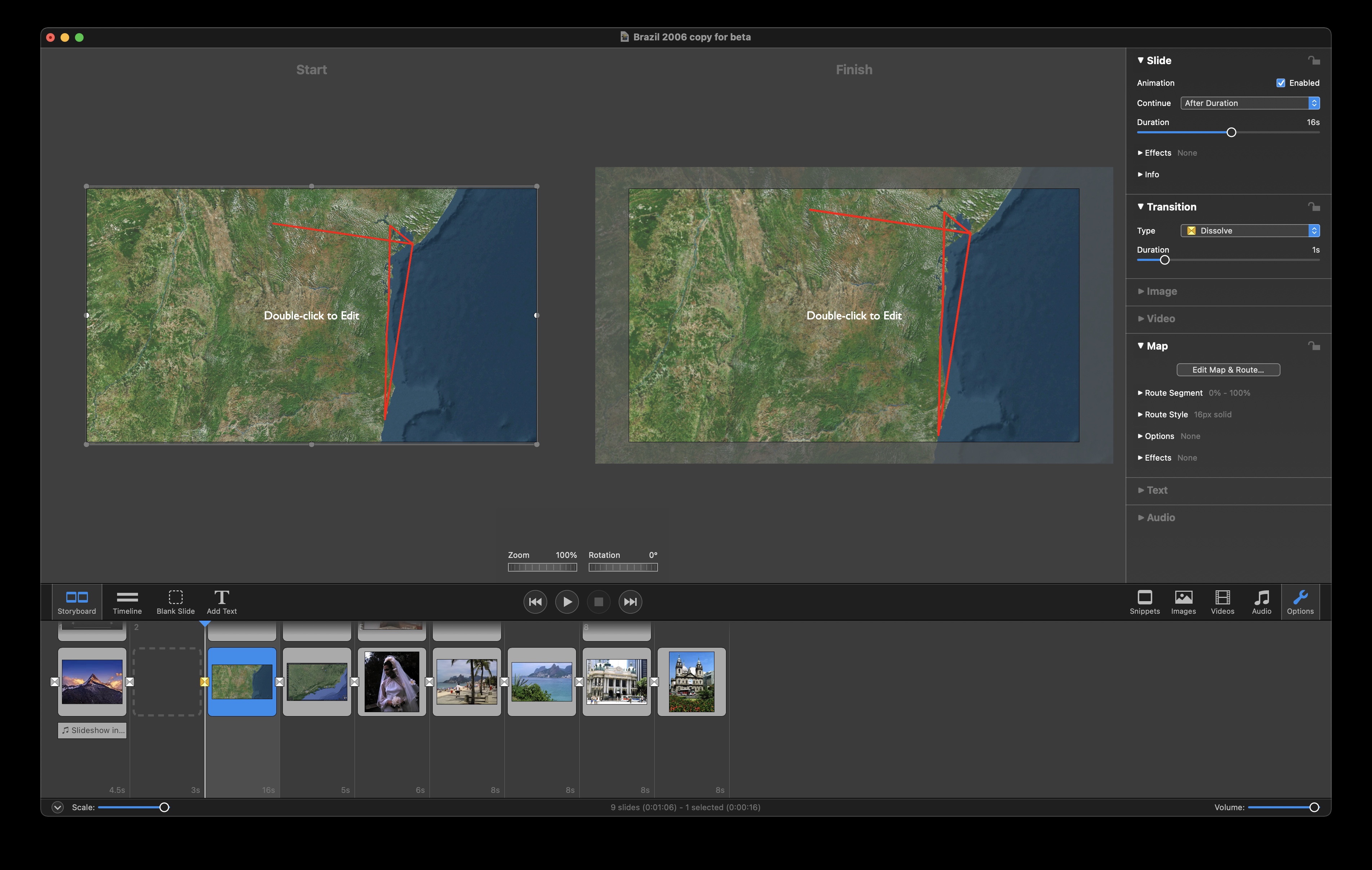
I am pleased to say I have made further progress with the Maps Assistant. I can confirm that if you save a route in Google Maps in the KLM format, you can use a free online converter called GPS Visualizer to convert it to GPX and then import to FM6b. The route can then be animated as required:
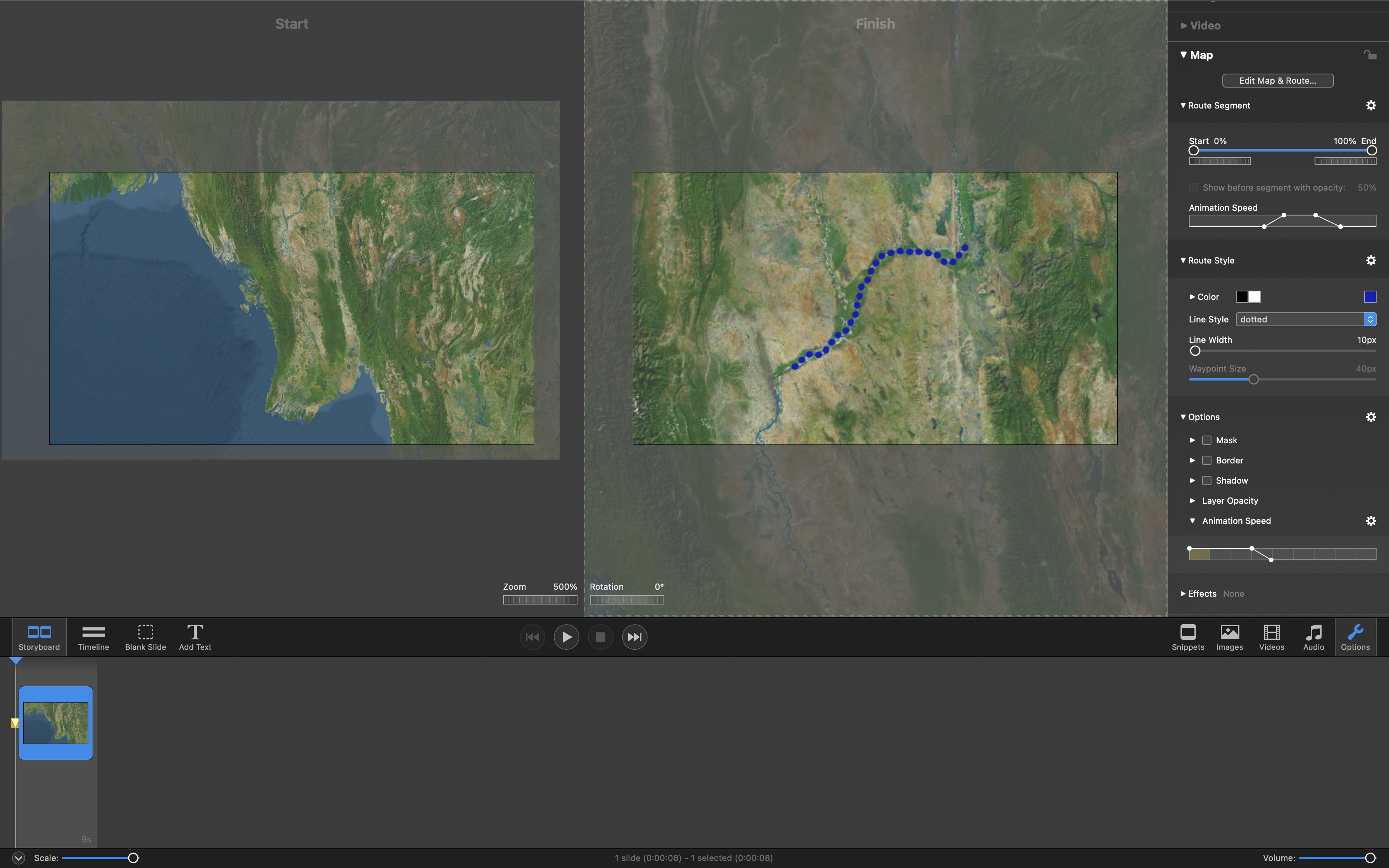
A couple of suggestions:
- Because of the heavy zoom, I was unable to get the route any thinner than it’s showing above. It looks a bit clunky, so it would be nice to be able to have a line width lower than 10px.
- The upper Animation Speed bar does not have dividers like the lower one does. These are useful when trying to get effects and animations to align with each other.
You can always enter value smaller than 10px via the text field…
the best one of these converters i tried is this one. All results could be displayed in FM6 beta without problems: KML → GPX Converter
Thanks for that Peter. It works.
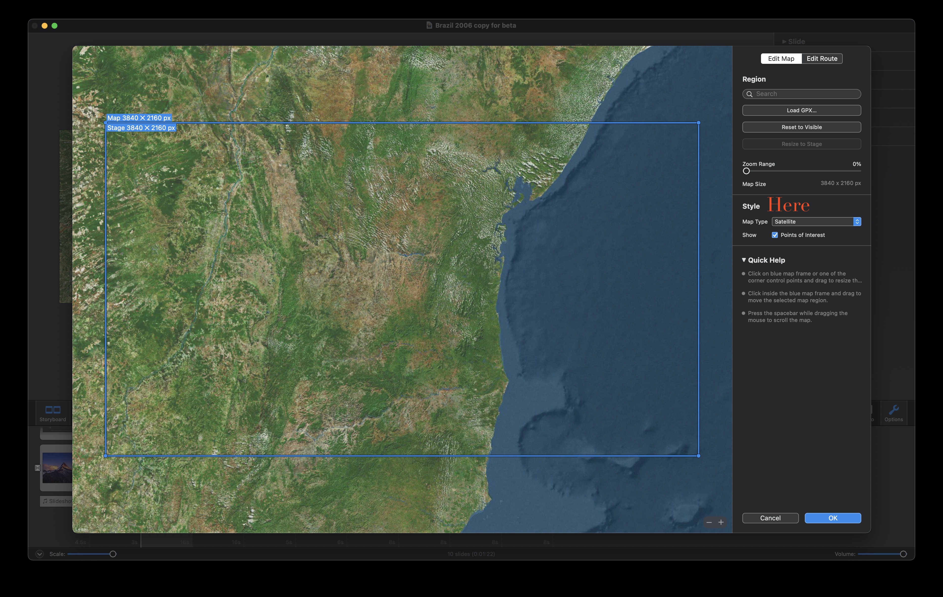
There is a bug in the maps assistant. I am able to resize by dragging the sides of the image but not the corners.
Another thing is that I am able to load a GPX file of a route, but when I do try to do that one that’s just a "PlaceMaker " FM6b hangs. I’ll send the error file to the beta help
Since FM 5 did not offer a Map Assistant, I’ve used to go with animated routes using the option “Ebene” which enables to switch from hidden to visible objects related to a defined location on a route. I could not find this option in FM 6 so far, it would be a great function for the new Map Assistant.
You can send the file directly to me at peter@boinx.com