After all this time, I still can’t get it to do what I want it to do! It seems totally counter-intuitive to me.
I want to create a map that will start out wide on Pakistan and then zoom in to show Islamabad in relative close-up. However, although I see the detailed image of the city when I start creating the map, when I add it to my slideshow I cannot zoom in to show that kind of detail. What am I doing wrong?
I have uploaded a screen recording here
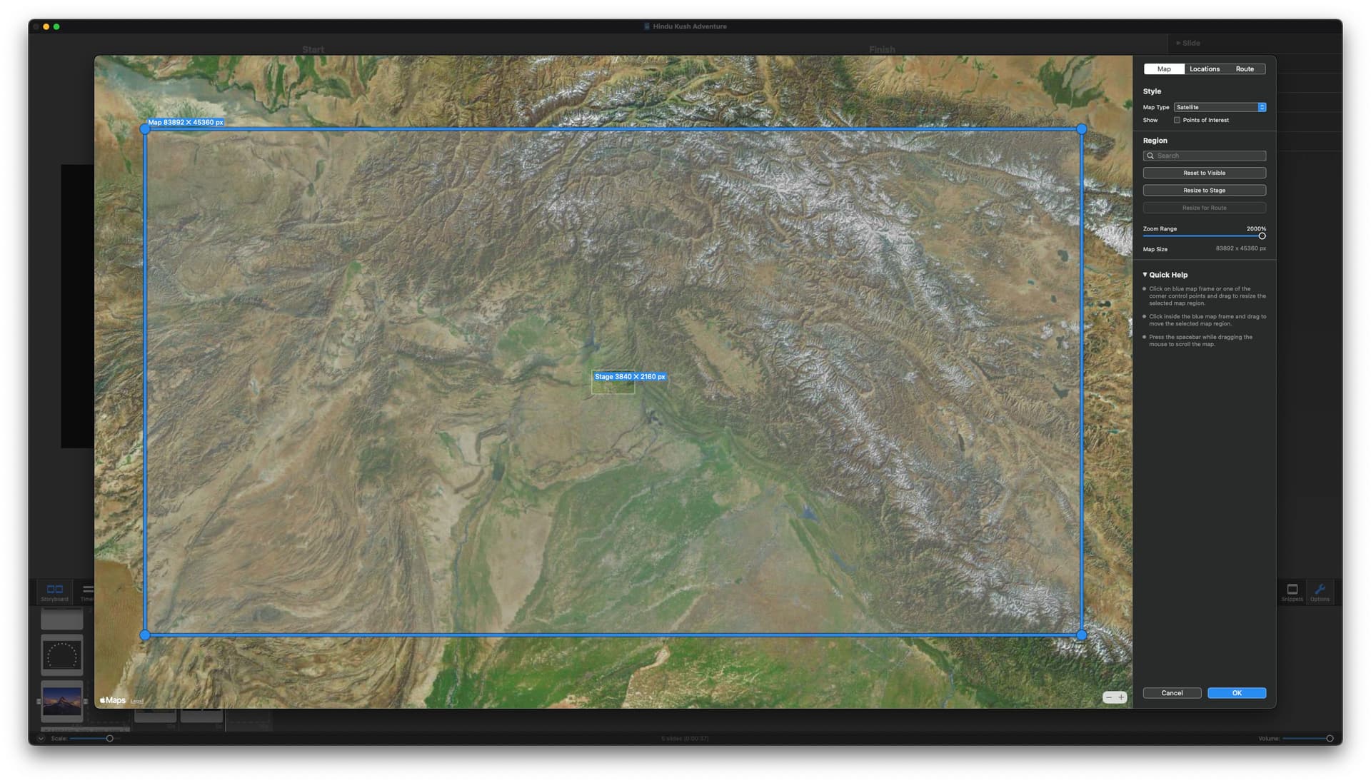
And here is a screenshot. When I click the OK button nothing happens. I am returned to my slideshow but the map has not been inserted.
I don’t use the Map Assistant that much (probably ONCE!), but I played around with it a bit to try to duplicate what you’re experiencing.
I notice in the screen shot that you have the zoom level set to 2000% – at first I wondered how you got that, since the slider only goes to 100%, then I realized that you must have clicked on the percentage and manually changed it. So I tried that myself and discovered that the MAXIMUM percentage you can manually enter into that field is 301% (why it’s got that weird value, I don’t know). It worked with 300%, but it didn’t work at 305%, so I just started lowering it and found that 301% works, but 302% did not. It may have shown that it was processing the image with a spinning circle, but it does not import into the slideshow (it’s just a black slide, or it doesn’t import at all).
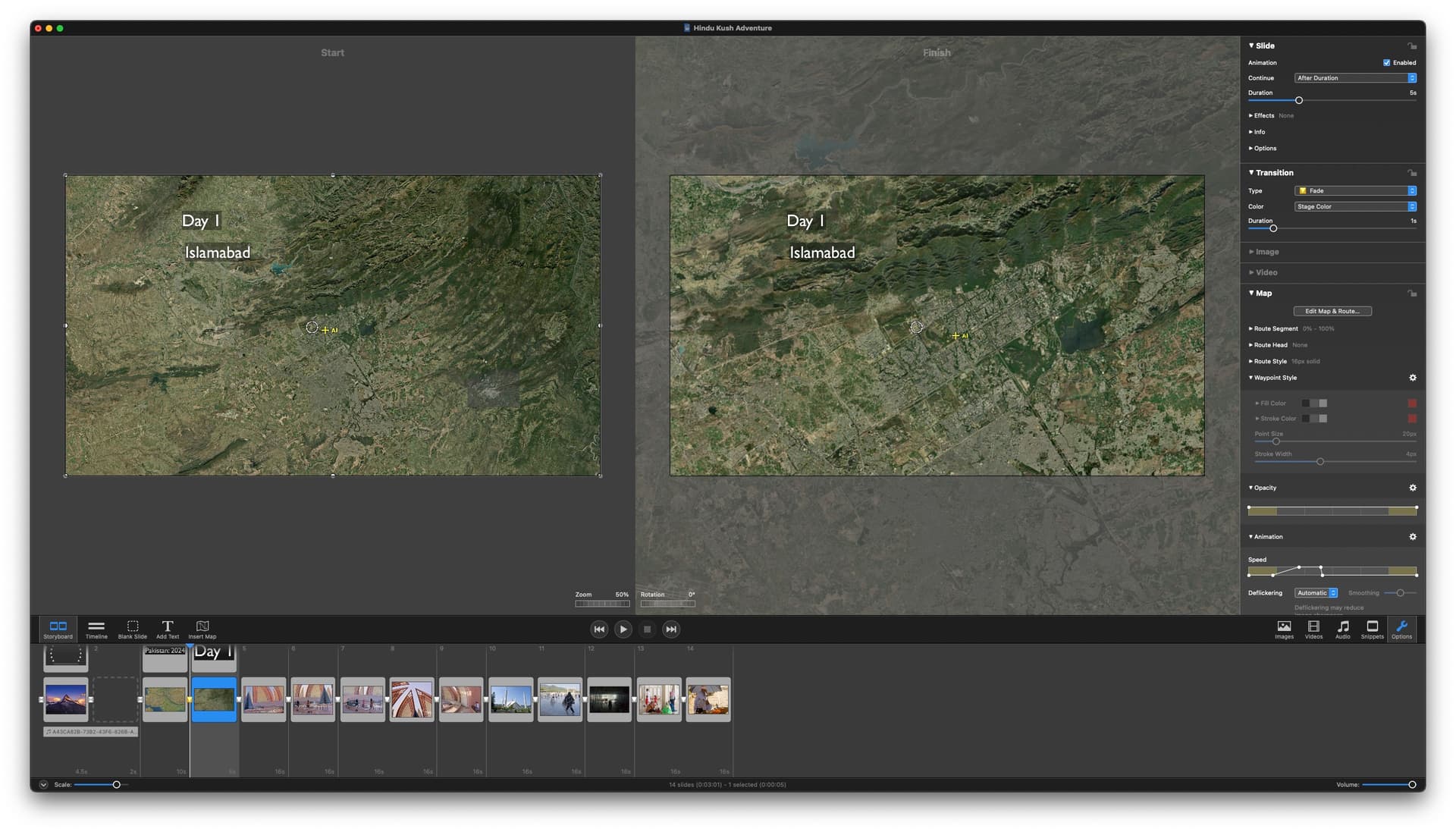
In any case, it seems like the max you can select is 301%. With that setting, the Map Assistant DID import the image into the slide show, where both the Start and Finish display the maximum image from the Map Assistant. Then, going to the Finish, I adjusted the Zoom control for that side and pumped it up to zoom in on a city, and it managed to maintain its clarity (it’s not SUPER sharp, obviously), but I can still see cars and people and whatever. You can’t expect 4K or 8K quality images all the way down to a snail on the sidewalk unless they were taken by the Pentagon, or Air Force, or CIA spy satellites. And I’m sure these map and satellite images were not.
So, what’s happening is you’re trying to grab 2000% (wide on Pakistan) and zoom in to Islamabad. But as it exists right now, I don’t think FM’s Map Assistant will allow that – you can only go out to 301% in Map Assistant at the most.
Maybe Peter can address this issue in a future update?
Thank you Stan I knew you’d come up trumps!
When setting the zoom to 2000, I certainly couldn’t apply it. But 300% is OK, even though it doesn’t achieve the dramatic effect I’d really like.
One other question you might be able to answer.
I set the zoom to 300%, but the map pre-zoom is set to 50% not 100%. Pst-zoom, if I set it to 300% the image is blurry, so assume it has to be a maximum of 150% to be clear. Again, this seems a bit illogical.

And Peter:
Can we have the ability zoom more dramatically in a future update please?
And maybe a more detailed tutorial on using the Maps module would be helpful. I am sure many of us are not getting the best from it as it is.
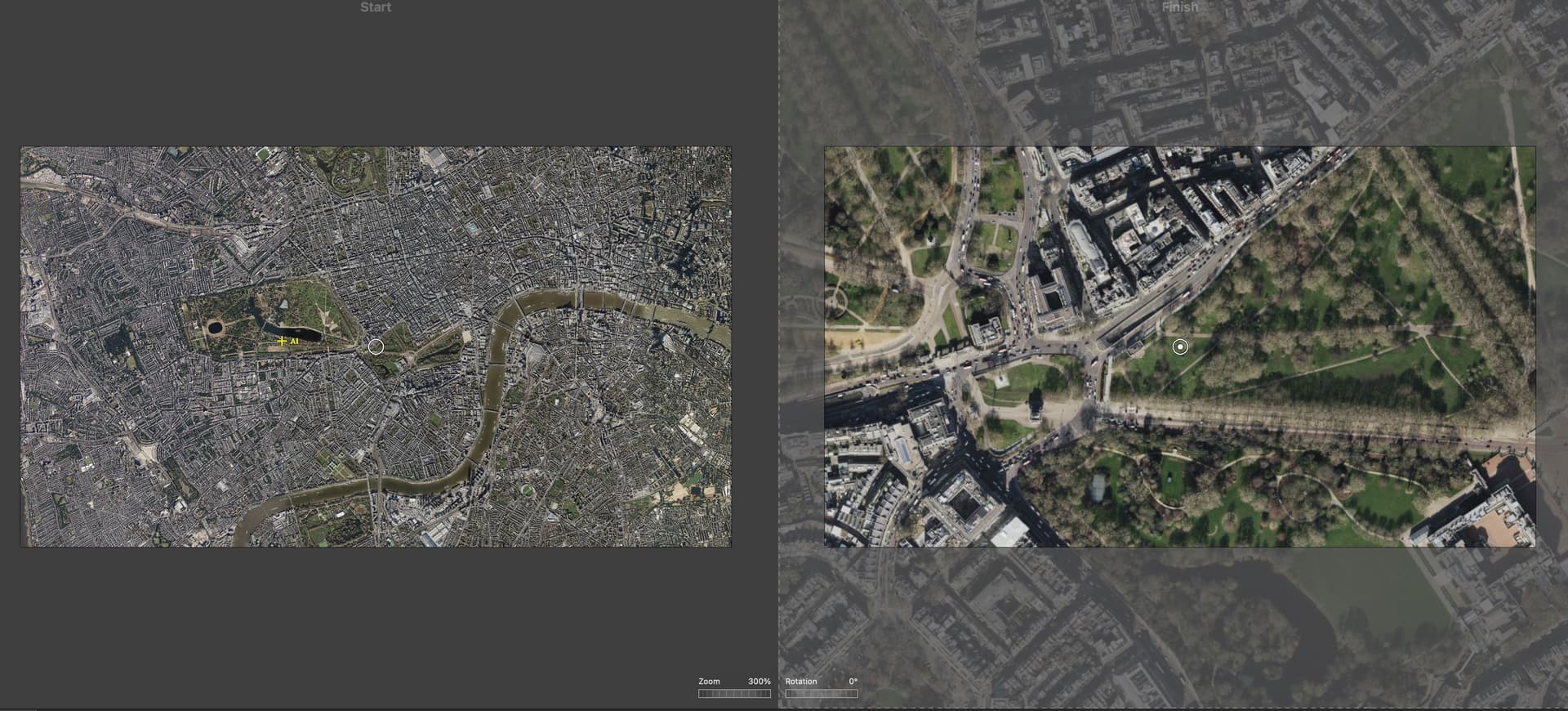
My stage is set to 16:9 (3840 x 2160). I set the slider to 300% image in Map Assistant and it imports to read 25% on the Zoom for both the Start and Finish. I have Animation Assistant set to “Fit to Stage” for both horizontal and vertical images.
Adjusting the Zoom to 300% on the Finish results in decent detail – I mean, again it’s not “great” – but the buildings and streets and cars, etc. show relatively good definition – they aren’t that blurry. I even pumped it up to 600%, and then 800% – still looks pretty good, considering.
Not sure where your “pre-zoom is set to 50%” is coming from. I guess a number of settings may be different between what you’re doing and what I’m doing, which may be causing the discrepancy.
It does seem illogical that one asks the Map Assistant for a 300% zoom and this gets imported as with 25% or 50%! Surely, the logic would be that it would come in at 100% and then the maximum one can then zoom in with decent definition would be 300%.
In the FM5 days, I used to do the kind of zooms I want with Google Earth and then import them as .mov files. But that didn’t allow route animation.
Yes – BUT – I’ve attache a screen grab of the top left portion of what my screen shows in Map Assistant when I manually set the Zoom Range to 300%. You’ll notice the values in the top left corner which show “15360 x 8640” for the large blue area – there’s no way to display that many pixels on screen (i.e. at 100%), so when it imports to the Timeline it scales it down to fit the stage, which in my case is 3840 x 2160, which is 25% of those initial larger dimensions.
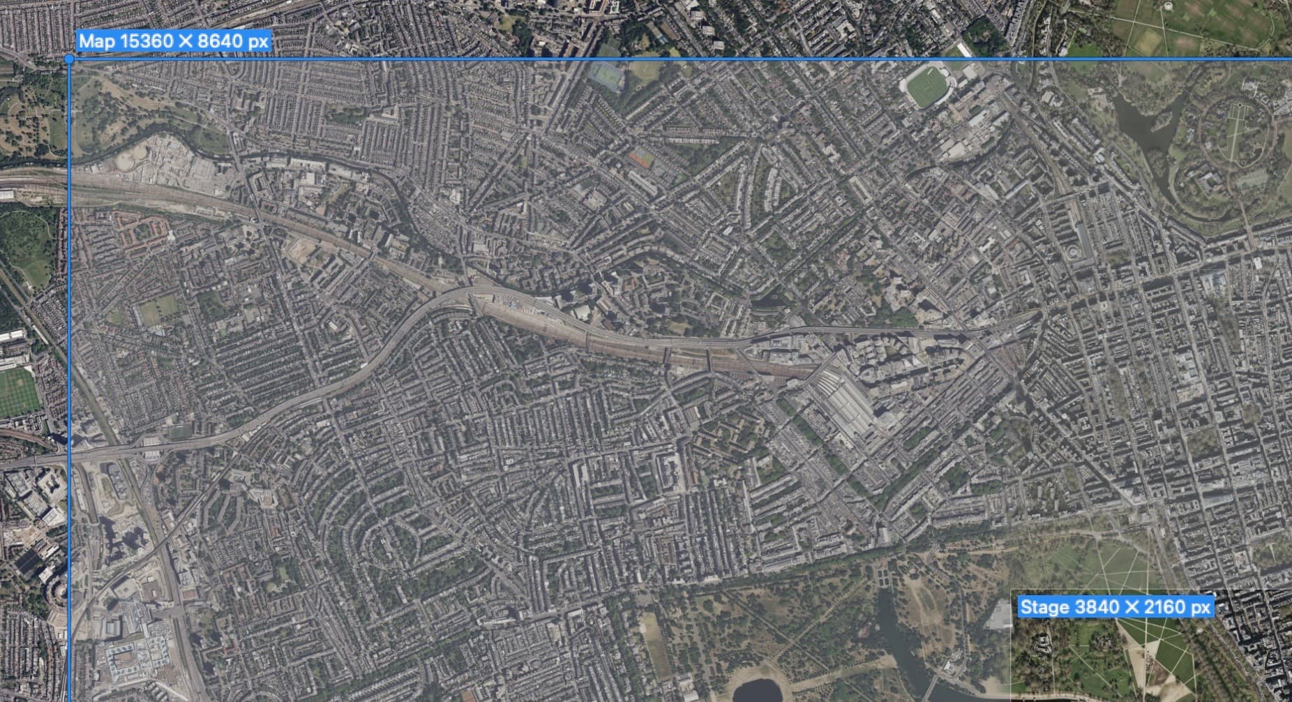
Look at this image and you’ll see the map sizes to fit the stage (3840 x 2160) and the Zoom is set at 25% automatically. If it came in at 100% it would be 4 times large and completely fall off the stage and lose everything around that center part.
Thanks for working that out!
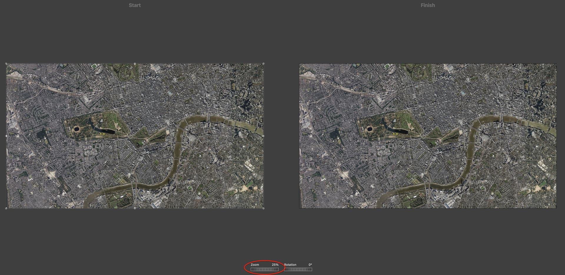
Does that mean that the right-hand side can be set to 300% without loss of detail?
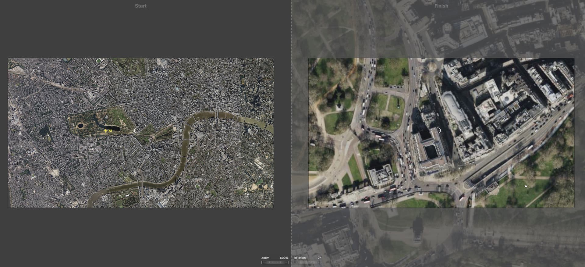
I’m sorry – I should have included an image where the Finish is set to a higher Zoom %. So, here it is at 300% – not too bad, really.
Here it is at 600% – but it’s starting to take on that blur:
I guess it’s just trial and error!